
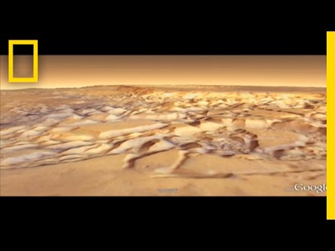
Moon and Mars and Google Earth are a lot
like a video game it’s pretty popular
right now to have these 3d virtual
reality games where you can walk around
or sometimes fly around and in Mars and
Moon it’s just like that except that you
can actually explore another planet and
they’re based on real data so instead of
exploring you know fake world and
shooting aliens you can actually explore
a real alien world and dive in and see
craters and explore and and also read
some of the human stories on those
planetary bodies where you can find out
how humans have explored those places so
we did Mars first because prior to
joining Google we actually both Knowland
I wrote software for NASA Mars missions
and we actually started the original
Google Mars which is a website before we
came to Google we called Google up and
asked them if we could make it basically
prior to coming to Google I worked on 7
Mars missions and the Cassini mission to
Saturn for Arizona State University as a
NASA contractor pretty much anything
that involved a computer on the ground
for those missions that were based at
ASU I was a lead for Mars and Google
Earth actually has imagery that I helped
create that Knoll helped create we both
worked on the Themis camera onboard Mars
Odyssey and there’s a global infrared
map of Mars both a daytime and a
nighttime map that lets you see what the
planet would look like if your eyes
could see an infrared so Mars and Moon
and Google Earth were a big challenge
for Google Earth because fundamentally
it was designed for just one planet
nobody ever thought that we’d
necessarily do other planets with it it
was called Google Earth so a lot of the
systems assumed that there was only one
planet they also assumed that the planet
looked like Earth Mars and Moon have
much higher lower and steeper terrain
than you find anywhere on earth so a lot
of these things broke assumptions about
you know that the software makes about
what planet it’s processing data for so
we had to enhance a lot of those things
one of the reasons that we put wanted to
put Mars and Moon inside of Google Earth
is that Google Earth is already a really
rich environment it supports a lot of
additional features that we haven’t even
gotten to yet but the 3d models that
we’ve included are Sketchup models and
there’s nothing that we did that’s any
different than what another user could
do in addition to Sketchup you know
Google Earth the language that you use
to talk to Google Earth is KML and so
using KML you can put your own data
your own lines points polygons basically
draw on the planet in 3d and produce
things like a exploration plan here’s
where you think the first explorers of
Mars should go here’s the path they
should follow here’s where they should
stay so the data and Mars and Moon both
come from a variety of sources we worked
closely with NASA most of the imagery
comes from NASA there’s also some
European Space Agency data all of this
from orbiting spacecraft and then
there’s of course imagery close to the
ground from the Rovers and from the
astronauts themselves they actually took
stood in place and rotated around and
took photos and we reconstructed those
into panoramas besides having the
European Space Agency moon also has
terrain data from JAXA the Japanese
Space Agency and without this we
wouldn’t have had kind of the full
global 3d effect it would have been a
flat planet my favorite part of Mars is
the historical maps Nathaniel Greene in
the late 1800s he was actually a
naturalist so he painted really good
images and he turned his attention to
Mars one summer and painted a really
great natural scene of Mars in 1870s
that was kind of blown out of the water
the next year by shepper le who did the
same thing the difference was is that
Nathaniel Greene was was a naturalist
and was good at observing details and
shepper le just kind of did it he it was
not his thing and he he made a very
fantastic map of Mars that had very
little bearing in reality yeah so margin
Google Earth has at least one little
hidden secret there’s a search tab just
like all the other Google products you
can search and if you search for the
face on Mars that will take you to a
very prominent and well-known landmark
that in the 60s the shadows kind of all
collided in a way that made it look like
a face right next to the face on Mars
there’s a little marker for it is a
little chap called Melissa and if you
click her open you can actually chat
with a Martian live this is based on an
old 1960s artificial intelligence
program called Eliza we had a lot of fun
putting it together
and she’ll kind of play the part of a
psychologist and try to help you with
your problems or if you ask her about
Mars she’s got a bit of trivia knowledge
yeah the biggest thing I want people to
be aware of is that Mars and moon and
Google Earth aren’t just standalone
products there are platforms and we
really hope that NASA embraces both Mars
and moon in Google Earth to do a lot of
science outreach and to do a lot of
actual research
Please follow and like us: